Back to blog
Apr 4, 2025
Case Study
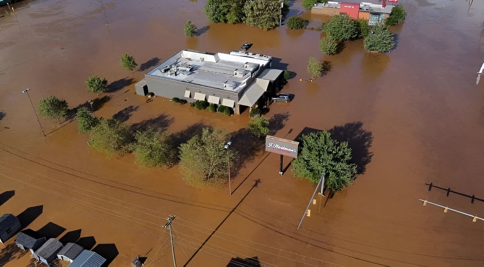
When Hurricane Helene struck the Southeastern U.S. in late September 2024, it carved a path of destruction from Florida’s Big Bend through Georgia, South Carolina, and into North Carolina. In the western mountains, McDowell County was hit hard—floodwaters rose fast, and wind damage was widespread.
Lieutenant Joshua Guthrie of McDowell County Emergency Services moved quickly. A skilled UAS pilot and longtime advocate for drone technology, Guthrie led the charge to map more than 3,000 acres of the most severely impacted areas. He turned to Nova’s orthomosaic tool to bring clarity to chaos.
“The fast processing and ease of exporting 2D projects in a variety of outputs allowed for thorough documentation and seamless sharing with Command, Operations, and community partners assisting in our long recovery,” said Lt. Guthrie.

Preparedness met opportunity—and made an impact. McDowell County was ready when their community needed them most.
Curious how Nova is helping public safety teams respond faster, communicate better, and save lives?
Get in touch. We’d love to show you what’s possible.